Basic Configurations
(See Price Structure)
Land
Instrument with LCD character display and standard sensor
(User supplies battery and charger)
This is the most basic system used for underground surveys. The control box has a transparent cover through which a 2.7″ Color graphic display shows all the system’s output. The operator input is through a five-key pad. The box has a belt to be carried round the neck at chest level.
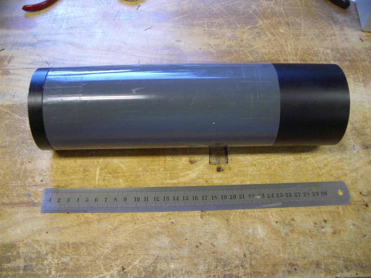
The sensor is a 30 Cm long cylinder with a belt to be horizontally carried at knee level.
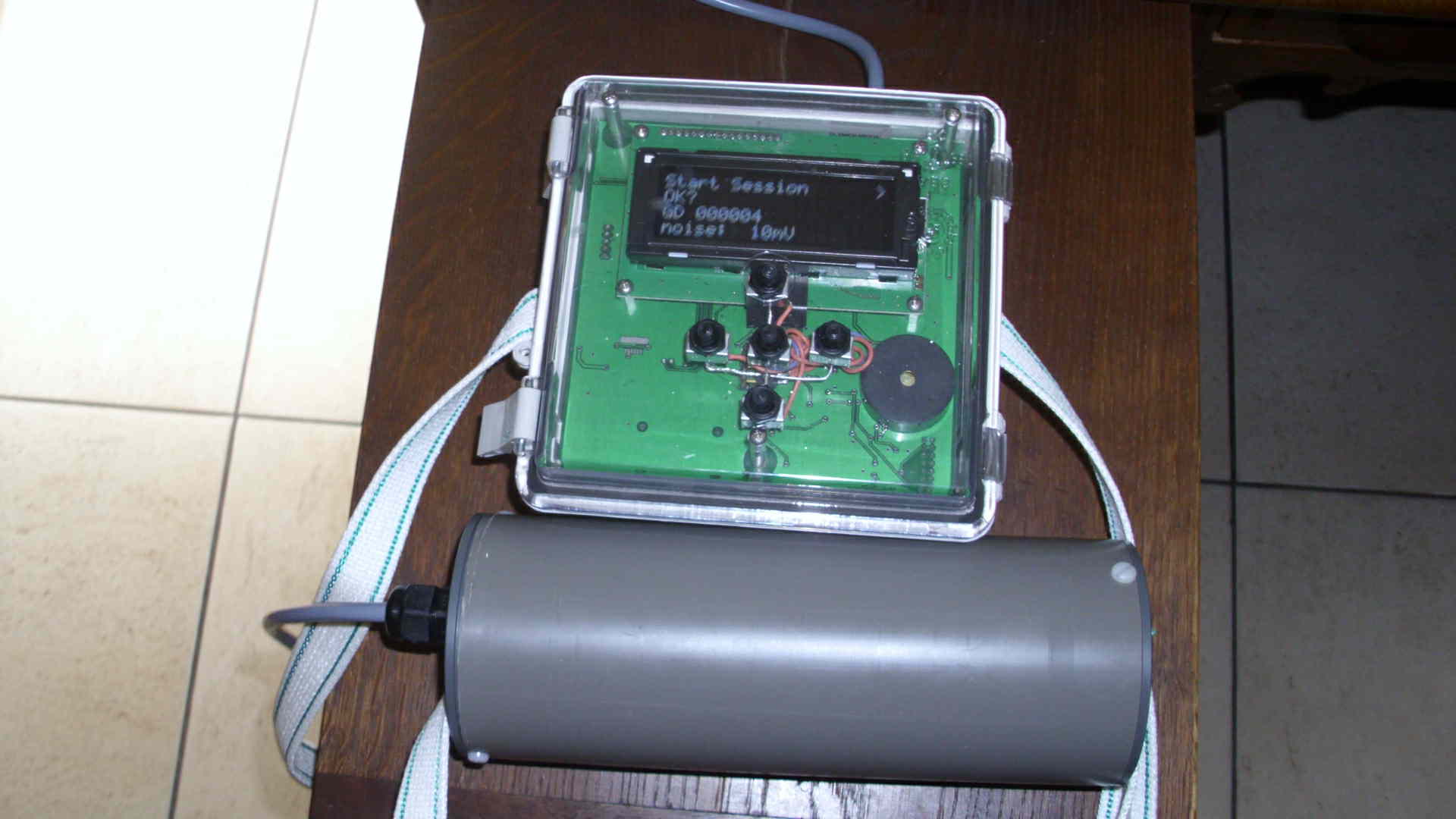
The electronic control boards of all the configurations is packaged in a Waterproof (IP66) NEMA box!
This configuration includes the license to run Windows-based PPM Utility program in post-processing mode. (No direct connection from the PC to the PPM.)
Underwater
Instrument with Color graphic display and underwater sensor
(User supplies battery, charger and cable needed from instrument to sensor)
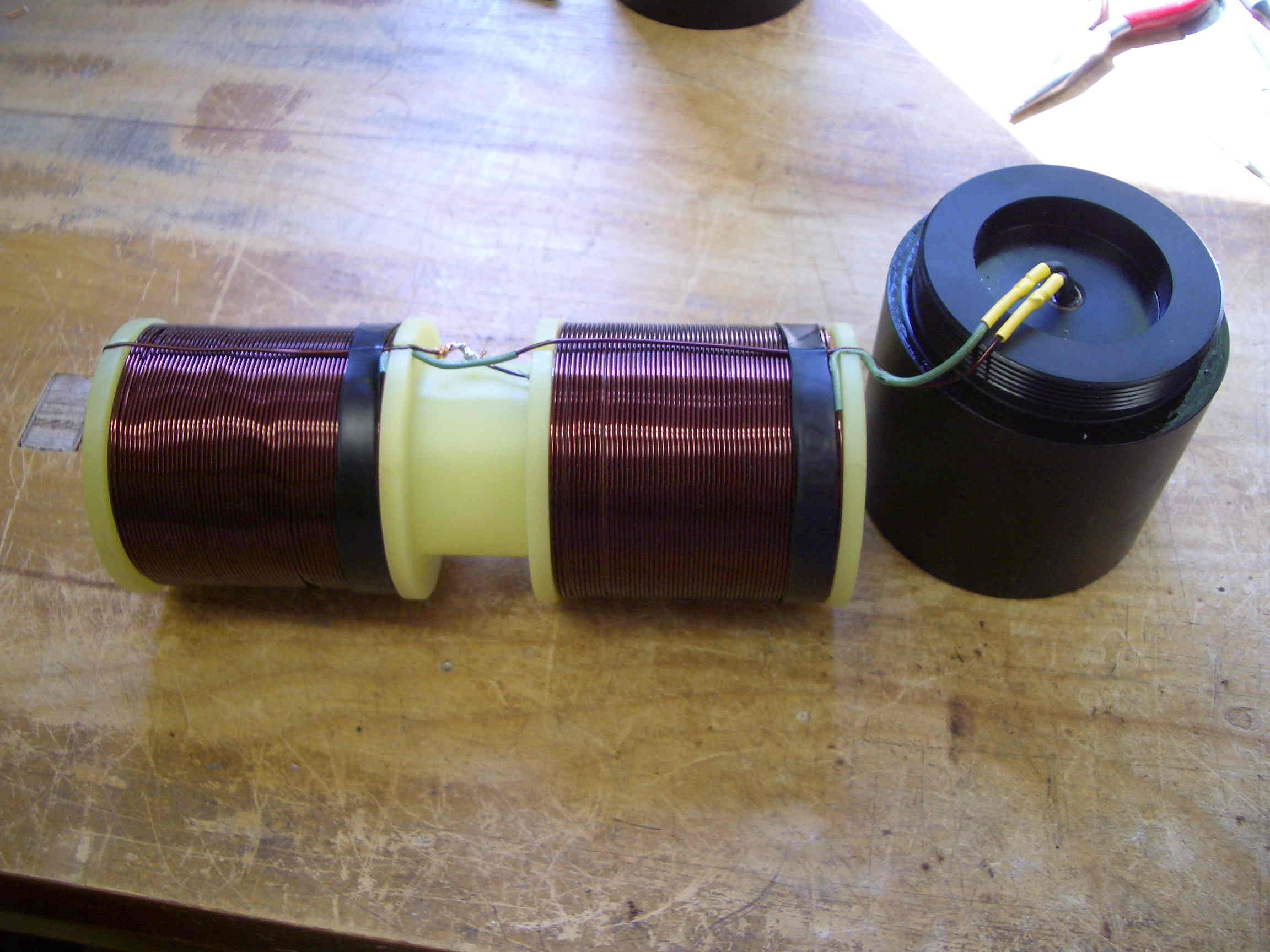
This configuration has the same control box as in the land version but the underwater sensor is supplied in a waterproof, sealed tube with appropriate connectors tested for a depth of 30 m. This sensor can still be used for underground surveys but, if inserted in an outer casing with nose, cable attachment point and fins, It makes a complete towing ‘fish’ for underwater surveys. The basic sensor is supplied with a short length of cable (1 meter) and a connector to be plugged either directly to the control box or to a user-provided shielded cable extension of a suitable length for the underwater surveys.
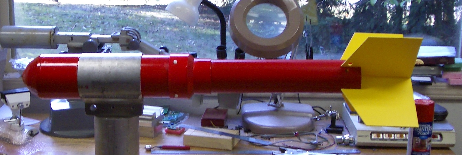
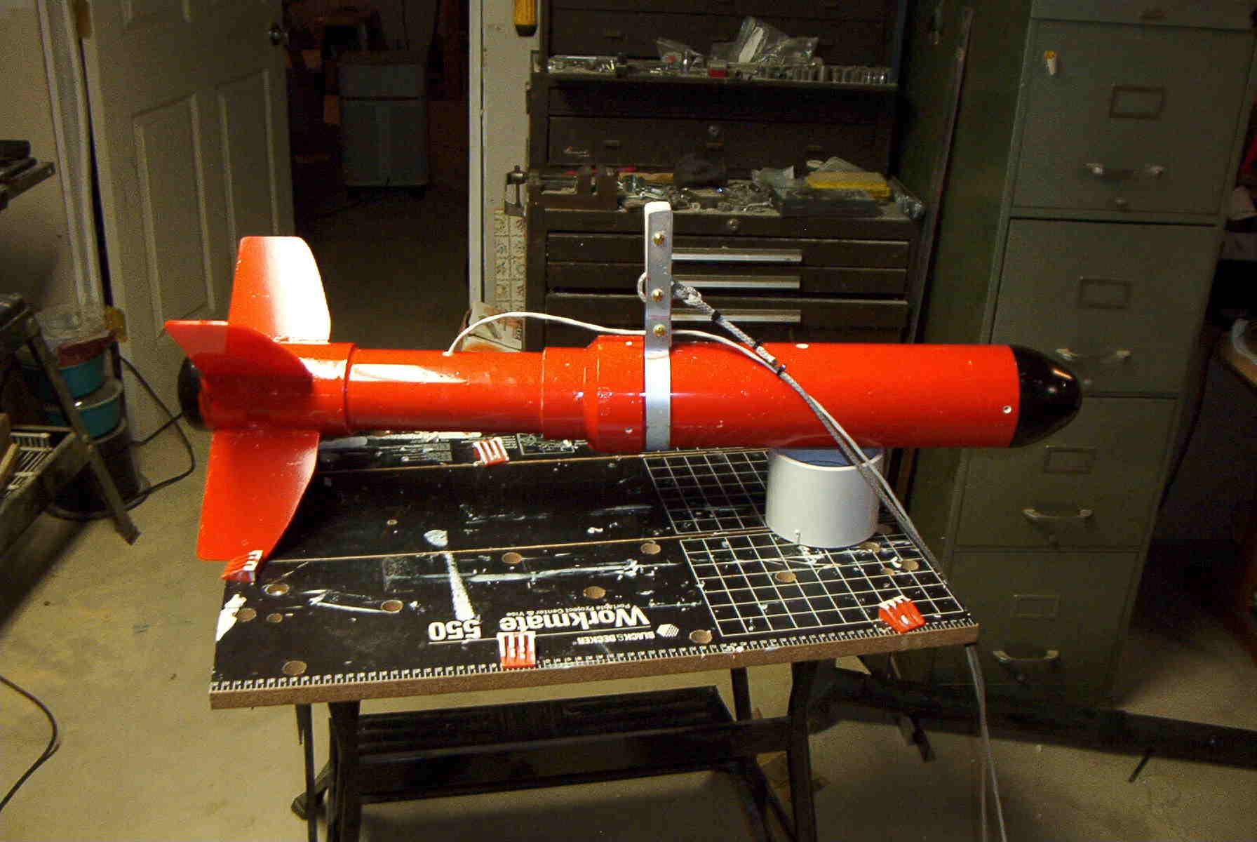
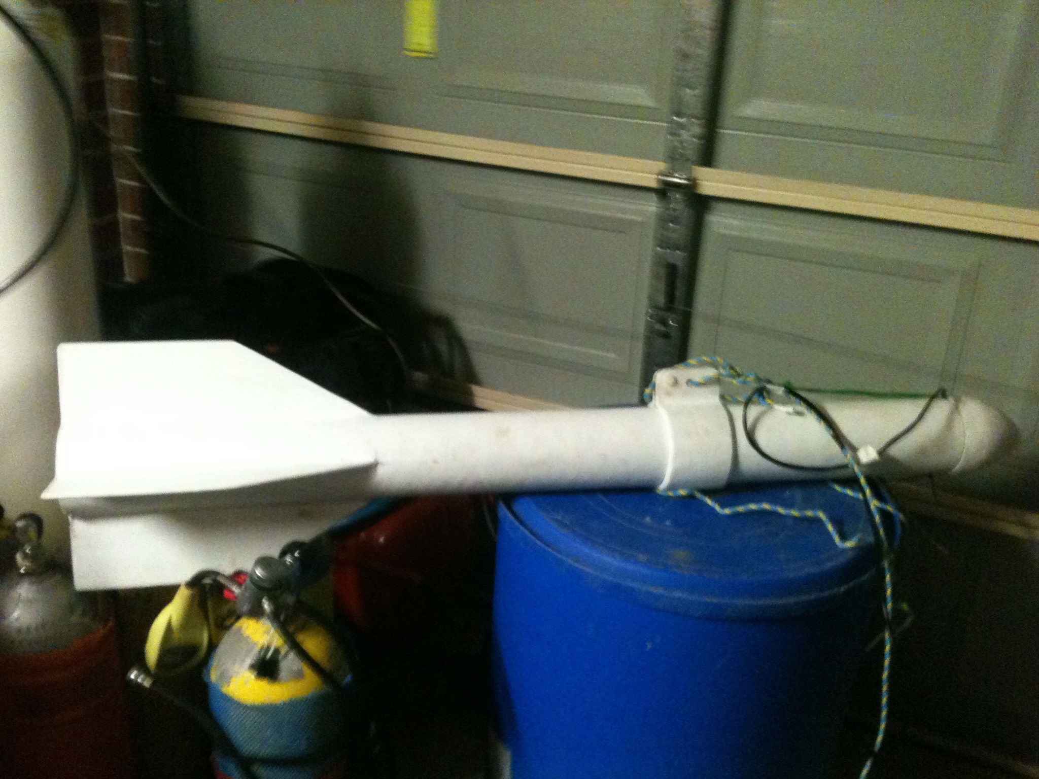
This is an example of fish design: Fish design
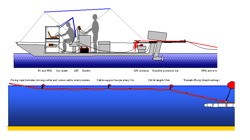
The following pictures show a number of fish implementations from our customers.

The electronic control boards of all the configurations is packaged in a Waterproof (IP66) NEMA box!
This configuration includes the license to run Windows-based PPM Utility program in real-time mode connected to a PC/tablet through a USB cable.
Additional Options
1. Optional sensor container designed for Deep Surveys (>= 100m)
This is the underwater sensor container equipped with a panel connector designed to sustain a depth down to 10000 ft.
2. Instrument with both sensors
User supplies battery, charger and cable needed from instrument to sensor
This is the complete land configuration with the addition of the sensor of underwater configuration.
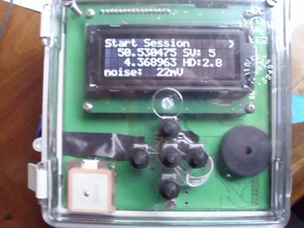
3. Addition of GPS
This option integrates a SIRFIII GPS module inside the control box and mixes the GPS fixes with each PPM reading on the grid files.
This option is highly recommended for underwater surveys.
4. Subtraction for instrument with no user interface
Supplied control program available for Windows XP, Windows 7 or Windows 8 and connected to the PPM through a USB cable or the optional Bluetooth module (see option 5.)
This negative option removes the user interface from the control box and replaces it with a more sophisticated Windows-based interface (PPM Utility program) on a laptop for real-time surveys made while sitting on a vehicle (sensor on a trailer) or a boat (sensor in an underwater fish).
This option could also be useful on a land configuration when carrying the PPM control box and its sensor in a backpack and using a Windows-based tablet for real-time control of the PPM.
5. Bluetooth link between the PPM box to a PC running the PPM Utility control program.
This option includes the license to run the Windows-based interface (PPM Utility program) in real-time mode.